
land management consultation
All our services begin here—with a consultation. Whether you’re looking for a full-service approach or just some direction to get you going, you need a plan.
This phase includes a property visit, discussions about goals for the property, and a desktop review of geospatial data and property maps.
A plan can include all of the items below or be more tailored to a specific project:
food plot strategies;
strategies to improve your deer herd;
plans to improve wildlife habitat in general;
timber management and harvest strategies;
invasive plant management planning;
reforestation plans;
how to implement government conservation programs on your land;
wildlife population monitoring;
prescribed burn planning; and
detailed proposed schedules for all of the above.

Wildlife & Ecological SErvices
Once we have created a land-management plan, Ridge & Valley is happy to help implement that plan by providing boots on the ground to complete the work laid out in your management plan. Some small landowners may have the desire (and equipment available) to perform some of the work themselves while others may want full-service management from planning to implementation and monitoring. We can accommodate either situation. Some examples of this work includes:
performing deer population surveys;
timber stand improvement;
invasive plant management by chemical and mechanical means;
herbicide application;
food plot planting and maintenance; and
tree and shrub plantings for wildlife

prescribed burning
Prescribed burns are crucial for maintaining and restoring habitat in which wildlife and native plants can thrive. Ridge & Valley can provide burn plans, create and maintain firebreaks, and conduct prescribed burns on your property.


Drone services
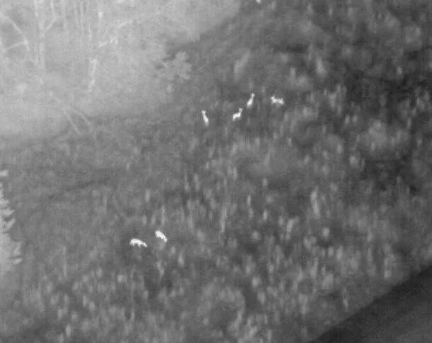
We specialize in thermal drone deer population surveys and deer recovery. Thermal drones allow us to estimate deer populations on properties and make assumptions about habitat use and movement. The use of thermal drones is also extremely effective in finding hunter harvested deer or wounded deer, leading to great increases in efficacy and decreasing wound loss.

Frequently asked questions
-
While all property can benefit from the implementation of sound management practices, Ridge & Valley mainly focuses on parcels of at least 100 acres. Regardless, don’t hesitate to call us for smaller projects. If we have time in the schedule, we’d love to help out.
-
We’d be happy to start the conversation whenever is convenient for you.
-
There are dozens of variables that determine the health of a deer herd from food availability and population density to neighboring land use and hunting pressure. Ridge & Valley can help you assess the influential variables at play on your land and help you use quality deer management practices to maximize the health of your herd and antler growth of bucks on your property.
-
Self-sustaining wild quail populations require large acreages and intensive habitat management. We can help you assess if (and how) your property can support a self-sustaining population.
-
Yes. Implementing the right habitat management practices can increase forage, nesting, and brood rearing habitat for turkeys even on small tracts.
-
It depends on your goals. Supplemental feed for wildlife and game species can increase carrying capacity and help wildlife health during times when food is limited; however, it can also cause issues with disease transmission and feeding of non-target animals that may be detrimental to the populations you’re trying to promote.
-
There are many variables to consider when selecting the best location to hunt. Food sources, topography, visibility, proximity to water and bedding cover are just a few. With so many variables to consider, making a decision can be overwhelming. We can help you make the right decision.
-
It depends on your financial and conservation goals. These two facets of timber management are often at odds with each other. We can help you find the right balance to suit your needs.
-
It depends on what your priorities are and the location you are trying to plant. Soil quality, soil moisture, and amount of sunlight are the basic considerations when choosing a crop. In general, mixes of legumes, grains, and brassicas or other non-legume forbs are flexible and durable options for most situations. However, perennial clovers can also be durable options that most wildlife will enjoy. We can create a custom plan for you to maximize your food plot success.
-
It depends on the scope of work. I’m willing to go almost anywhere in the country for consulting and planning work. For habitat management work on the ground, we can service Northwest Georgia, Northeast Alabama, and Southeast Tennessee.
